Field Documentation Software Built for Surveyors & Engineers
Capture defensible, GPS-tagged field evidence in real time — without enterprise complexity or enterprise pricing.
Rugged Technical StandardField documentation shouldn't be a liability.
A single missing photo or undocumented observation can trigger massive legal headaches. In the high-stakes world of surveying and engineering, the cost of disputes far outweighs the cost of the right tools.
PAPER NOTES THAT DISAPPEAR
Weather-damaged notebooks and coffee-stained scribbles aren't evidence.
PHOTOS WITH NO LOCATION OR TIMESTAMP
Unverified images are useless in a professional dispute or audit.
ENTERPRISE TOOLS BUILT FOR MEGA-FIRMS
Bloated software with expensive licenses that small teams don't need.
"The average construction dispute costs over $50k in legal fees alone."
THE ZIAMAP DIFFERENCE
ZiaMap is a mobile-first field documentation app built specifically for small surveying and civil engineering teams who need high-precision data without the high-overhead complexity.
GPS-TAGGED
Every capture is pinned to a precise coordinate. Location is no longer a guess.
TIME-STAMPED
Immutable temporal data ensures your evidence stands up to any scrutiny.
SYNCED FEED
Field data flows into a single, defensible evidence feed in real time.
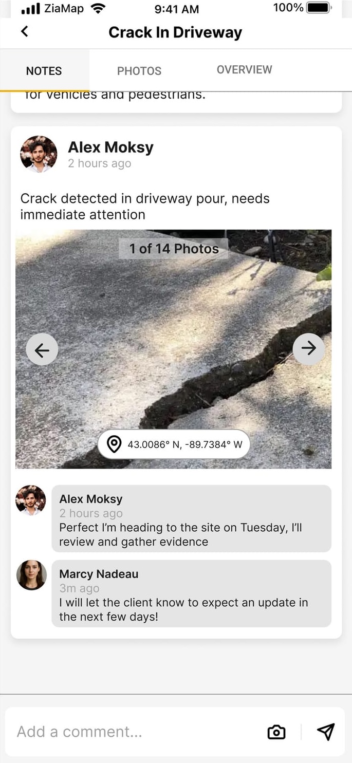
THE EVIDENCE FEED.
The Evidence Feed is a real-time log of every photo, note, and observation captured in the field. It's the spine of your project documentation.
-
AUTOMATICALLY ORGANIZED
-
LOCATION-VERIFIED
-
READY FOR REPORTING
WHO IT'S FOR
SURVEYING FIRMS
Eliminate the office-field gap. Get clean, location-accurate data back to the drafting desk before the crew even returns.
CIVIL ENGINEERS & INFRASTRUCTURE TEAMS
Document inspections, site visits, and progress with audit-ready evidence that holds up in court.
BUILT FOR TEAMS
No complicated user hierarchies or enterprise administrative layers. Just add your team and start documenting.
FAST ONBOARDING
Zero training required. If you can use a smartphone camera, you can use ZiaMap. Be field-ready in minutes.
AFFORDABLE ALTERNATIVE TO PROFESSIONAL HARDWARE
Professional tools don't have to cost thousands. High-performance software at a fraction of the cost.
HELP BUILD THE FUTURE OF FIELD DOCUMENTATION
JOIN THE BETA PROGRAM
Designed for the field. Engineered for simplicity.